Redistricting Plan
Kansas Least Change Plan

Author: Catherine Seita
Redistricting Principle(s) Prioritized: Least Change
Date: Oct 17, 2021
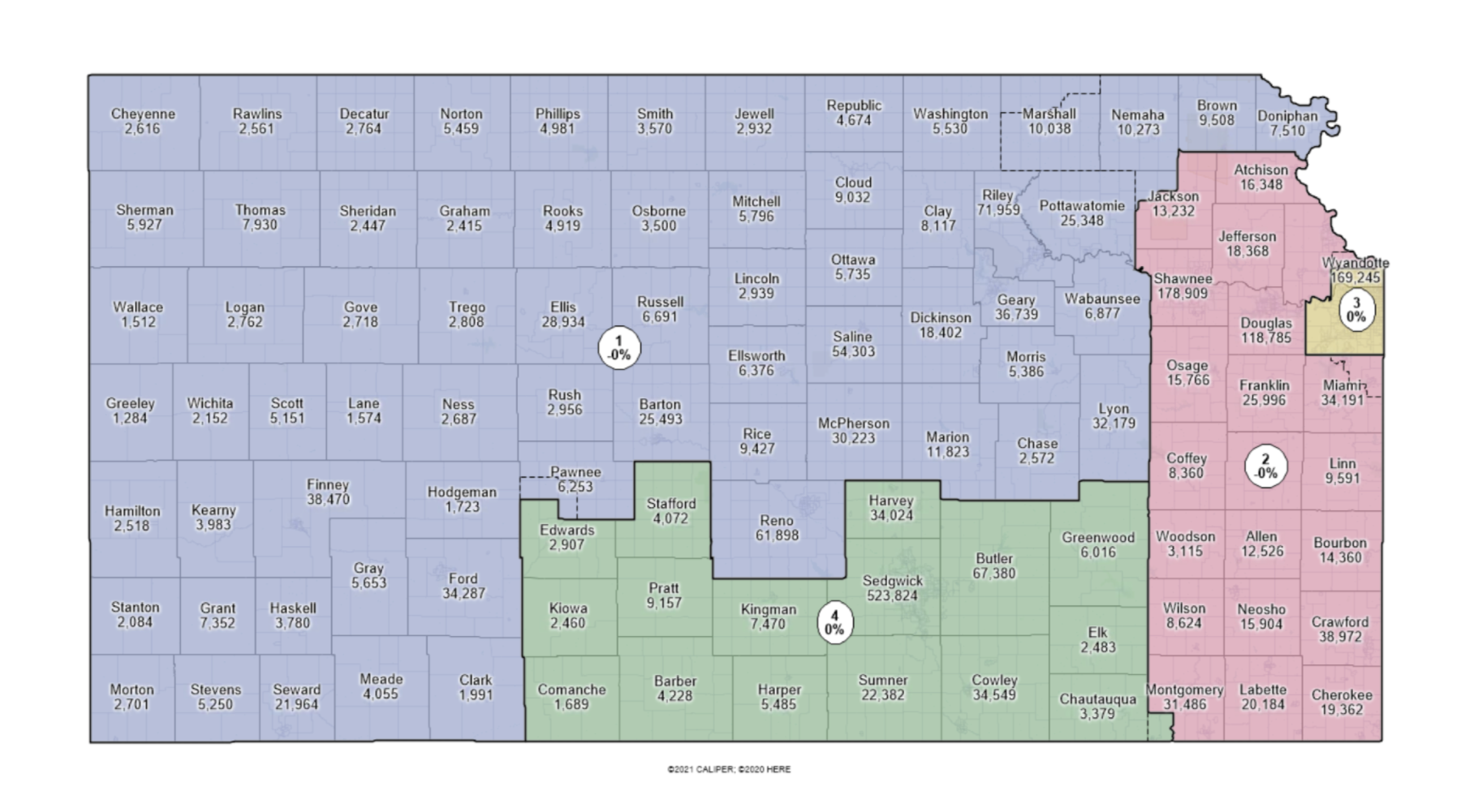
This is a least change plan that alters the current district lines as little as possible, while still aiming to keep county lines intact. The planned districts have perfect population equality and split only three counties. Additionally, the map complies with federal and state redistricting laws.
Plan Description
| Complete Plan Description |
Plan Images
| Image of Statewide Plan |
| Mapbook |
| Comparison with Prior Boundaries (dotted lines) |
Documents
| Plan Score Assessment |
Summary Statistical Reports
| Compactness Report |
| Political Subdivision Splits (Counties) |
| Community of Interest (Cities and Towns) |
Demographic Breakdown of Districts
| Demographic Data |
Plan Data
| Block Equivalency CSV |
| Boundaries, GeoJSON |